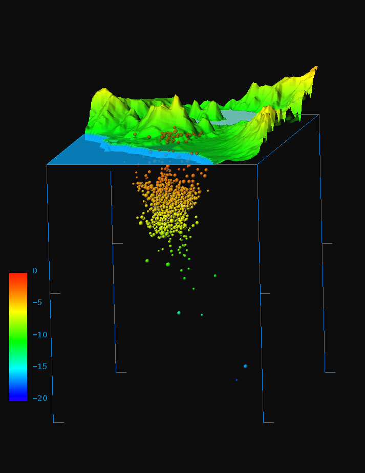
This figure employs data displayed in the figure (p.4) attached to the records of the Earthquake Research Committee's evaluation and has been depicted three-dimensionally by our office staff to convey an image of seismic activity.
In this figure, the perpendicular direction of the topographical map is enlarged to five times the scale of the horizontal, but, as regards seismic activity, the perpendicular
and the horizontal are the same scale.
The figure gives a slanted bird's-eye view of the area of seismic occurrence from the ocean side (SSE) of Mt. Usuzan. In the background can be seen a part of Lake Toyako. The deeper the earthquake, the bluer it appears, and the shallower, the redder. The radius of an earthquake's sphere corresponds in size to the magnitude of the event.
to the text of Hokkaido
to supplementary reports of Hokkaido
Japan Meteorological Agency,Science and Technology Agency